
Bikepacking the Mawson Trail

Your full guide to having an awesome time on the Mawson Trail
Words - James Raison
“Would you do it again?” Was a frequently asked question after riding the Mawson Trail in 2017. The answer was an emphatic yes, so when another group began planning a trip for Easter 2019 I jumped in keenly. This one would be more “adventure spec” than 2017. It’s a tough 7-day itinerary bookended by big days.
Before I jump in, I want to impress that there’s many ways to enjoy the Mawson and I’ve done these two:
Ride the Mawson Trail: sleep in the well-spaced towns’ accommodation, carry just spare parts and clothes, and chill in regional pubs before sleeping in a bed. I had a jolly good time doing that last time. It’s logistically easier and you sleep better. Read my Riding the Mawson Trail article for full instruction on how to do that.
Bikepack the Mawson Trail: Roll out a sleeping bag and bivvy in a hut, caravan park or pile of soft dirt, eat tins of beans and spaghetti, and become one with the stink of well-worn kit. That’s what this article is about. Having now done both, I can say that this is the more rewarding and enjoyable way. Everything is earned and nothing taken for granted. You’ll be smellier, less comfortable, poorly rested, sunburnt, and eat repetitive food. But I loved it. Those with a taste for adventure will find this the seminal Mawson Trail experience.
Want to support this content? It’s all completely self-funded to help people have an awesome time on a bike. So feel free to buy me a coffee! Every little bit helps me keep making guides like this.
QUICK GUIDE TO THE MAWSON TRAIL
In short; the Mawson Trail is an 900-ish km mixed surface trail starting a few kilometres from the Adelaide CBD and ending in Blinman the Flinders Ranges. The trail is utterly brilliant. It is mostly hard packed gravel roads but includes everything from smooth tarmac to rocky single track. There’s eye-popping magic and world-class cycling to be found at the top end.

The ever-present and omnipotent Mawson Trail signs
Riders can choose to their direction; South-North from Adelaide to Blinman like I’ve done twice, or North-South begin in Blinman and ride back to Adelaide. I’d encourage South-North to everyone because the Flinders Ranges is a worthy crescendo to days of hard work. It’s a visual feast after fighting the winds, having your bones rattled on the corrugations, and willing your bike to survive the punishment. Riding to Adelaide will not have the same magic. I’ve also ridden in a lush September and a barren brown April and would pick Spring as the best option. No matter what the season, cross your fingers it doesn’t rain. Enough precipitation will end your trip as the red roads turn to bike destroying mud.
BIKE SETUP
I decided to dedicate an article to our 2019 Bikepacking Setups for the Mawson Trail. Check that out to see 4 different setups that were used on this trip. It’ll show the diversity of bikes that can be suitable.

NAVIGATION
The Mawson Trail is amazingly well signposted at every direction change which will be your main point of reference when riding. Beyond that I recommend downloading a GPX file and shoving it into your GPS device. Easy. As a backup I use RideWithGPS’s phone app - monthly subscription required - and download all of the maps so you can check the trail, and your location on it, without any phone coverage.
I made a RideWithGPS route and marked out all of my sleeping stops and a few points of interest - ie the best food and where Magpie Satan lives - and you should definitely check it out, steal it, adapt it, pull it to pieces and make it your own.
A note on phone reception; Telstra and Optus will have coverage a lot of the time with occasional dead spots. Vodafone peasants, like me, will have nothing for most of the top end of the trail. I’d recommend people buy a prepaid Telstra sim if they want to guarantee good coverage.
SUPPLIES
There’s plenty of towns along the trail so you just need to do some research on opening times to ensure you have what’s needed. Most huts had tanks with running water that are safe to drink with an Aquatab. My itinerary below includes notes on what you can find each day and what gaps you’re looking at between each supply spot.
People with alternative dietary needs or preferences may find the Mawson challenging. It can be done as a vegetarian with relative ease, fully vegan is a challenge sometimes. Some establishments are very accommodating and will alter food options for you while others literally laughed at us when we asked if they had anything without meat.
Day 1 - Start to Riverton - sleeping in Marschalls Hut
163 trail kms, 2,750 climbing, 8 km to the hut from Riverton. View on Strava
Our first day on the trail was a monster with the biggest distance and climbing totals for the trip.
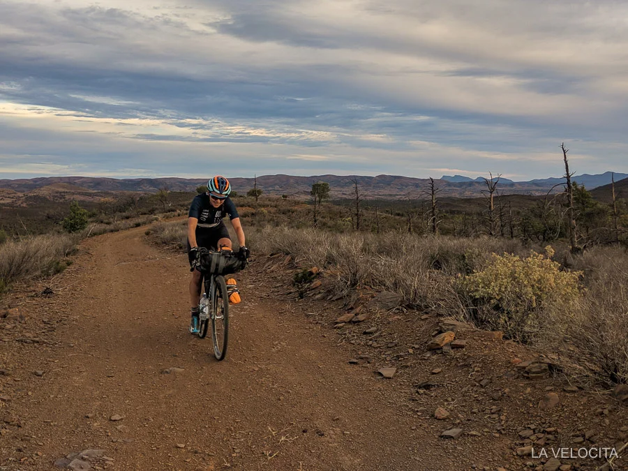
Stone Hut Road - the first 5 kms of the Mawson - are the most challenging you’ll face on any day. Steep, pitchy climbs followed immediately by descents and then climbing again makes it the slowest stretch of the whole trip. There’s some cracking views of the nearby reservoir though. You’ll divert briefly through the Fox Creek MTB trail network before rolling into Lobethal. The next kms are pleasant to flippin’ beautiful gravel roads taking you to Mt Crawford Forest. The day’s highlight is undoubtedly Trial Hill Road and the descent down Steingarten Road into the outskirts of Tanunda.

Steingarten Rd is a good looker
Tanunda and Nuriootpa offer plentiful supply spots and flat road kilometers before you exit onto more gravel backroads and rumble towards Kapunda. It’s a long uphill drag for the next 30 km before cresting Gants Hill Road and getting treated to a beautiful view, plus a gradual downhill run into Riverton where we recommend a stop in the pub to sample their unbelievably good hot chips.
Sleeping: Marcshalls Hut is a roof over flat surfaces with some running water and nearby long-drop toilet. It was the most basic place we slept but the views from its hillside were gorgeous. Expect a gradual 8km drag uphill from Riverton if you stay here.

Gaps and supplies from Trail start:
15 km to Lobethal: everything
19 km to Birdwood: bakery and cafes
67 km to Tanunda: everything
7 km to Nuriootpa: fast food
48 km to Kapunda: bakery, pub
44 km to Riverton: general store, pub, cafe
8 km to Marshalls Hut
Day 2 - Riverton to Mt Bryan Schoolhut
160 km, 1,900 climbing. View on Strava
Heading out of Riverton towards Clare has some rolling hills as you wind between the paddocks. Once through Auburn you’ll hit the popular Riesling Trail which is a bike path for people who don’t like riding bikes. It’s a 20 km 2% uphill drag of cured gravel that will drive you comatose with boredom. It’s designed for people to ride around wineries, get sauced, and ride back to Clare in relative safety. On a positive note; Clare is a lovely town with stacks of eating options and multiple supermarkets.

The stretch into Burra features fun paddock roads and some of the earliest “big views” of the Trail. It starts to feel properly rural out through this stretch. The outskirts of Burra throw a fun curveball as you loop around for some steep climbing and a rough limestone drop into the town where you’ll find more cafes than residents. Our kinda town!
It’s a dramatic stretch to the Mt Bryan Schoolhouse, and a long haul for anyone pushing on to Hallett. It begins with some dreary highway-adjacent dirt track before you make turn into the conservation park in the Mt Bryan area. Stock up on supplies in Burra because it’s a barren stretch. The Mawson loops around the Hut and we chose to take the longest way there and reduce the following day’s distance. Expect plenty of tough climbing and some bomber descents charging over rocks and churning plenty of powdery white dust. It’s an enjoyable part of the Trail as you cross the valley floors and then climb your way out and through the remote farms with plenty of sheep and kangaroos to dodge. We made it to Mt Bryan Schoolhouse around 7.30 pm which meant some of the glorious views were lost in the darkness. Oh to be riding during daylight savings!
Mt Bryan Schoolhouse: A spacious building with two sleeping areas that have double-decker platforms, sink and small kitchen, and long drop toilets. There’s a working fireplace too if you’re responsible enough to use it. Not a bad hut overall.
Gaps and supplies starting in Riverton:
20 km to Auburn: cafe, IGA, pub
25 km to Clare: everything
45 km to Burra: cafes, IGA, pubs
65 km to Mt Bryan Hut
Day 3 - Mt Bryan Hut to Curnows Hut/Jamestown
115 Trail kms, 1,161 climbing. View on Strava
The morning shift has you riding through some amazing farmland along the valley floor before gradually climbing out and dropping down into the very small town of Hallett. There’s a bike washing station set up in the park for giving your steed, or body, a spray. There’s a charming general store run by a lovely man who has set up a USB charging station and some comfy old couches to sink into while you eat. He was stoked to have five famished cyclists drop in and eat a pile of food before stuffing more into their bikes. Drop in, say howdy, and stuff your face!

All. The. Brown
Hallett to Spalding is a tough section in the wrong conditions, which we obviously had. This is wind farm country for good reason; it’s windy as all heck. Plus we had a glorious but grotesquely hot and sunny day in the mid-30s. The climb up Parker Road and over the ridge line was brutal and we flopped under the lone tree growing at the top before having a comically slow wind-limited descent down the other side. The terrain undulates gradually down and the trail follows an early 20th century concrete aqueduct through farmland. Get used to opening and closing gates through this stretch too. There’s a very cool bridge to ride over before arriving at Spalding with a general store, a pub that only serves dinner, and little else.

Brown.
The dry paddock bashing continued well into the afternoon, only broken up by some long draggy climbs along exposed roads. We dropped down to ride adjacent to the RM Williams Highway, the brand having its roots in nearby Jamestown, before smacking into the steep and rocky climb that gets you to the edge of Bundaleer forest. A fun round of paddock bashing and gradual descent leads you into the gorgeous Bundaleer Forest proper and the Curnows Hut where half of our party slept the night. The other half, me included, decided to push in to Jamestown for a big feed and a restorative indoor sleep after the brutality of the first three days.
Gaps and Supplies starting at Mt Bryan Schoolhouse:
20 km to Hallett: small general store, pub, bike washing station
45 km to Spalding: general store that doesn’t like making food without meat, and a pub that doesn’t do lunch
36 km to Curnows Hut
12-16 km to Jamestown from the Hut depending on whether you take the direct route or follow the trail and get off trail at the closest point
Curnows Hut: It’s a basic setup with sleeping platform, running water and sink, and toilet. I can personally endorse the cabins at the caravan park which is where I slept.
Day 4 - Curnows Hut/Jamestown to Melrose
96 km, 1,014 climbing. View on Strava
This was a day we needed after the hammering of the first three.
It’s a fun stretch from Curnows Hut through Bundaleer forest that pops you out into some fast-rolling and undulating back country roads. This stretch ticks over quickly and there’s a satisfyingly gradual 30 km drop into Laura where it’s mandatory to buy Golden North ice cream that’s made in the town.

We decided to give way to these 600 sheep
A bike path leads out of town before turning to climb into the hills. There’s some rocky and deeply rutted single track, a welcome change from the dirt roads, which then lead into the brilliant Wirrabara Forest. Expect plenty of pitchy climbs and one of the rare shady sections of the Mawson through here. Being surrounded by lush trees was quite the novelty for us after spending so long in brown and red environs. It’s a challenging final stretch into Melrose with seemingly endless climbs before giving you get a flying descent right into town.
Melrose is a town revitalised by a large MTB trail network installed some years ago making it the bike friendliest place you’ll visit. There’s a fully fledged bike shop; Over the Edge that can fix you a killer coffee, and sell you replacement parts or spares. You’ll find a service centre in there too if you’re in dire need of help. The trails are almost within view of the Main Street, just on the outside of the caravan park so feel free to unload your bikes and shred.
Melrose Caravan Park: We set up an impressive, and rather funny looking, bikepacker town across a couple of grassy powered caravan sites. We had access to the bathroom blocks and cooking facilities for the bargain price of $12 each. Melrose is a 2 pub town and I’d recommend the Mt Remarkable Hotel having eaten at both. It’ll accomodate vegetarians and vegans, all while featuring a banger salad bar.

Gaps and supplies starting at Curnows Hut:
13km ish to get close to Jamestown which has the biggest bakery I’ve ever seen, a large supermarket, and multiple pubs
42 km from Curnows Hut to Laura with IGA, multiple cafes, and a pub
60 km to Melrose with bike shop, cafes, pubs, and a small general store
Day 5 - Melrose to Dutchmans Hut
76 km, 733 climbing. View on Strava
A short day gave us the option to faff about in Melrose and enjoy our first proper breakfast at one of the cafes. Rolling out of town the Mawson zig-zags through paddock-access roads. We split the group as some of us wanted to investigate the trail trail that connects Melrose and Wilmington. It’s a cruisy trail, if a little uninteresting, that is more efficient than taking the Mawson through that stretch.
Wilmington is an oddball town that has some fun diversions for those willing to spend the time. First there’s a Landrover and toy museum for those interested but the highlight is undoubtedly the second hand store. We had a ball sifting though the gear and buying silly comfort items for $1 each including some bamboo thongs, hats, beanies, casual shorts, and Carl’s floral shawl which he used to live his best life for the rest of the Trail. Definitely go in there.

Exiting Wilmington is where the first tastes of the Flinders Ranges start. It feels less like rural farmland and like proper remote areas of infinite views and big skies. Our party rumbled along in good spirits, stopping to snatch plenty of photos. It’s rarely flat and is dominated by long climbs and equally relaxed descending. There’s a sting in the tail of this section as you get close to Quorn with a slap-in-the-face climb up some loose rocks and shifty dirt. Your reward is a loosey goosey descent, then a flying paddock downhill to the road into Quorn. We arrived early enough to visit the cafe, IGA, and head to the Dutchmans Hut to dump our gear before enjoying an unladen ride back into town for dinner. It wasn’t an efficient way to eat but fun nonetheless.
Dutchmans Hut: I’ve stayed in hotels worse than Dutchmans hut in my backpacking days. It’s a 10 km uphill drag from Quorn to reach it but the reward is electricity, a ceiling fan, microwave, flushing toilets, and a shower in the nearby homestead. The hut’s pretty darn clean on the inside too with a table and bench seats. We spread out across the hut with some sleeping on the double-decker platform, some opting for spacious front porch, and Matt taking the shearer’s quarters.

Extra credit on this day went to Matt and Karl who rode most and walked some of the trail up to the Dutchmans Stern. The rest of us were skeptical if it was even possible but the intrepid fellas put in the work for an amazing view at the top. Big kudos to them for their ambition that looked well-rewarded.
Gaps and supplies starting at Melrose:
20 km to Wilmington on the Rail Trail
30 km to Wilmington on the Mawson with a pub, cafe, and general store/service station on the main road on the edge of town
40 km to Quorn which is quite the watering hole with 4 pubs, multiple cafes, and a well-stocked IGA
10 km to Dutchmans Hut
Day 6 - Dutchmans Hut to Mt Little
129 km, 613 climbing. View on Strava
This was the day we showed the Trail who’s boss by pushing into the relentless headwinds for long enough, and exceeding our originally planned sleeping spot far enough, to make the 7 day itinerary possible. I’m downright proud of the group for this gritty day.
We faced two routes to start the day because of how Dutchmans Hut is located: backtrack to Quorn to rejoin the Mawson - which Matt and Karl did because they’re badass completionists - or roll down the Dutchman’s access road and ride along the sealed road which joins up with the Mawson a few kms later - like the rest of us did. The section from Quorn starts with a dull flat road before a fantastic climb up Yarrah Vale Gorge Road. The views at the top are a worthy reward before dropping down and hitting Arden Vale Road and thundering through the protected Warren Gorge. It’s been a highlight of both trips up the Mawson as the (sometimes) windless valley lets you wind up the gears and fly. My memory was clunking into the 34x10 and pinning myself to Matt’s wheel for a tow. Great fun!

You’re properly in the Flinders Ranges as you exit the valley and get walloped by some awe-inspiring views of rock formations jutting out on all sides and a road that seems to infinitely wind through the middle of them. The landscape is harsh, and the climate can be too with no shade nor shelter from the winds. We stopped in a dry creek bed for a morning snack before plodding on over the bumpy track that wiggles along next to the highway before crossing it and heading for the desert oasis of the Cradock Pub. There’s a surprising amount of vertical metres earned on the way there before you drop down and have a straight-shot to the Pub which is the only thing in Cradock. The publican there is utterly hilarious; a builder who bought it and has done substantial renovations - even between my visits in 2017 and 2019.

It was hard to peel ourselves off the chairs and into 30 km of headwinds to reach Hawker along a single flat road but we got there eventually where we made the decision to push onto Mt Little for the night instead of the planned Mayo Hut. Leaving Hawker is a glorious section, truly one of the Trail’s finest. Be aware of the steep and rocky descent down onto Mt Little Rd. It’s a sudden and nasty surprise. We got treated to one of the best sunsets I’ve ever seen and even a section of tailwinds as we pushed into the night. It took us some time to work out exactly what Mt Little was, none of us having been there before. It was a tough stretch but we were stoked to find Mt Little was a series of campgrounds with a massive outdoor kitchen complete with gas burners, pots, crockery, and nearby toilet/shower block. It’s a managed campground and you do need to pay to stay in this area so be sure to contact Mt Little Station through their Facebook page. It comes highly recommended. This is an absurdly beautiful area.

Mt Little gave us a stunning sunset
Gaps and supplies starting at Dutchmans Hut:
76 km to Cradock direct from Dutchmans
90 km to Cradock via Quorn for the completionists
25 km to Hawker: pub, general store, service station
26 km to Mt Little Campgrounds: outdoor kitchen, water, bathroom with showers and toilets
Day 7 - Mt Little to Blinman
160 km, 1,695 climbing. View on Strava
Our original 8 day itinerary was switched to 7 when we crunched the numbers and found our extra efforts the previous night put us just 160 km from the end of the trail. Calling ahead to Blinman we snapped up a motel room for the 5 of us and faced down a big day, but one made palatable by finishing a day early and the prospect of sleeping in beds. It was a very tasty carrot.

Rawnsley Park Station
The first hours were brutal with the wind kicking up immediately as we broke camp and limited our speed to around 18 kph for the first two hours. We rode through the Mt Little area and dropped down for 12 dull kms along Leigh-Creek Road. Sealed roads become undesirable at this end of the trails as we yearned for the bumpy but car-free dirt sections of the Trail. Leaving the highway put us onto the infamous stretch of the Mawson into Rawnsley Park Station known for being gorgeous but heavily corrugated. On Strava the segment is aptly named “Corrugation road hell.” It can be a punishing bit of road for a lot of bikes. My 2017 trip was aboard a $700 Specialized Rockhopper I bought for a laugh two days before the trail and I wanted to kick it to death after this stretch of road. My beloved Bombtrack Beyond+ 2 on this trip was brilliant, floating over the rough surfaces with aplomb and only occasionally shaking violently from the road surface. Try not to chew stem for this whole stretch because the views are some of the best on the Mawson. Another lame highway stretch of 10 km gets into Rawnsley Park station where the caravan park general store has all the snacks and shade a bikepacker could want adjacent to a swimming pool that calls to you with a siren song.
It’s a single track rock party around Rawnsley; the first but not the last section of the day that wants to destroy your bike. My group in 2017 lost a rear derailleur in this section to a bouncing rock that would see Sam have to abandon the trail soon after, within 50 km of the end. Tragic. Thankfully we all ploughed through safely and onto the road to the Wilpena Visitor’s centre for our final resupply before finishing the trail.

The stretch between the Visitor’s centre to the final tarmac to Blinman is some of the best cycling you’ll ever do. It’s one of my most treasured experiences on a bike and I’m lucky enough to have done it twice now. It’s 14 km of descending through quiet forests with no walkers or vehicles in sight. You don’t descend very quickly but it felt like full hellcat mode after a week of averaging 20 kph. As enjoyable as the Trail is, this is where it’s most fun. We all joyously flung ourselves down with tyres skidding, filthy bike rattling, and constantly reaching for cameras to try and capture the magic.

The downhill party is ruined by the legendary Rrazorback Ridge climb; a brutal wall that gets you to you epic shot of the Mawson Trail pictured above. You work very hard for this view, having to overcome 20% gradients and heavy corrugations. It’s oh-so-worth it though. The following trails that take you back to the tarmac are plenty of fun too with undulations, spectacular ridgelines, and gnarly creek crossings. It’s littered with campgrounds and a couple of huts too for anyone wanting to sleep. Eventually you flop out onto the road and face the slow drag into Blinman. We obviously rode it like a TTT with a hotly contest sprint to “win the Mawson”. The final trail sign is the sweetest of all; mounted on the verandah of the Blinman Pub and pointing straight into the front bar.
Gaps and supplies from Mt Little
67 km to Rawnsley Park Station
25 km to Wilpena Visitor’s Centre: substantial supermarket, toilets
68 km to Blinman
Extra credit - Parachilna Gorge
31 km, 182 climbing. View on Strava
It’s become semi-traditional to roll down from Blinman to Parachilna to either catch the bus back to Adelaide or get picked up. It makes logistical sense but the main attraction is the ludicrously beautiful Parachilna Gorge. You just have to do it!

Parachilna Gorge is an extraordinary place
The road begins with some short climbs before settling into a 20 km descent, then roughly 10 km of flat road to Parachilna. Getting home can be done easily through Genesis Transport who run a minubus with a trailer from Parachilna to Adelaide on Tuesdays and Fridays, and Adelaide to Parachilna on Mondays and Thursdays.
Looking back on my second Mawson trip, I’m struck by what a gift this Trail is. Adventure riding is exploding in popularity for very good reason; it strips cycling back to beautiful simplicity. Waking up with only the goals of riding your bike to eat food and find your next sleeping spot is liberating. You’ll bond with your bike and with your ride buddies through common purpose and shared enjoyment. So, get on out there and do it! I’m already starting to plan the next time I load up my bike and ride somewhere beautiful. I look forward to sharing it too!

As always, thanks for reading! Hopefully this gives you some help and inspiration in tackling this glorious stretch of trail.